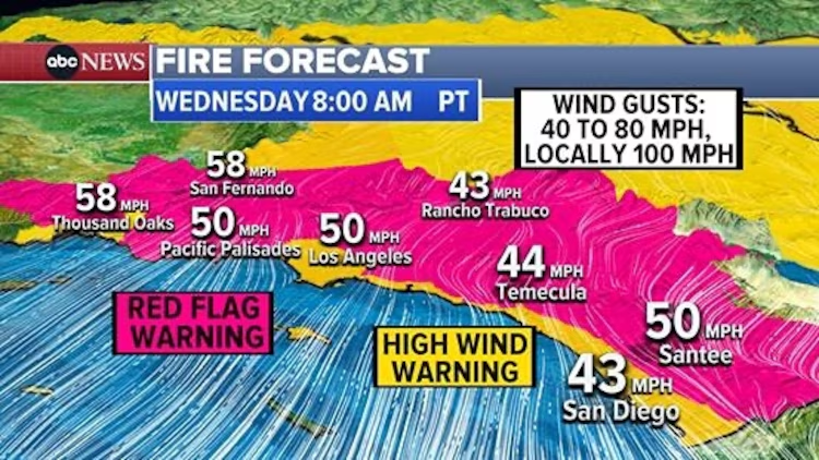
(LOS ANGELES) — A damaging Santa Ana wind event was peaking early Wednesday and winds were expected to stay strong through early afternoon in Southern California, fueling three wildfires that were quickly expanding early Wednesday around the Los Angeles metro area.
The Palisades Fire had grown to at about 2,921 acres, the Eaton Fire was about 1,000 acres and the Hurst Fire was about 500 acres, according to the California Department of Forestry and Fire Protection. All were zero percent contained.
Wind gusts were recorded at 99 mph on Mt. Lukens in the Eastern San Gabriel Mountains, at 98 mph on Saddle Peak in the Santa Monica Mountains and at 84 mph at Hollywood Burbank Airport.
Relative humidity in the area is very low, less than 10%. It has been very dry in Los Angeles, in fact October through December period was the sixth driest on record last year.
Downtown Los Angeles only saw about 0.16 inches of rain since Oct. 1, where it usually sees as much as about 4.53 inches.

An extreme fire risk warning was issued from Malibu to Burbank, along with Simi Valley and San Fernando.
A “Particularly Dangerous Situation” red flag warning was set to continue for Los Angeles until 4 p.m. PST on Wednesday.
The same type of warning was also issued for Orange County, and the damaging winds are expected to extend all the way to San Diego county.
A warning of critical fire danger was extended all the way to east of San Diego.
On Thursday and Friday, winds will begin to relax and relative humidity will begin to climb.
Copyright © 2025, ABC Audio. All rights reserved.


